Hikurangi Subduction Earthquakes & Slip Behaviour
Project period: 2016 - September 2021
Organisations: GNS Science, NIWA, Victoria University of Wellington, Massey University, University of Auckland, University of Otago, and the University of Canterbury
Project location: East Coast of the North Island of New Zealand
Introduction
 Nō te tau, rua mano, tekau mā ono, tae noa atu ki te tau rua mano, e rua tekau mā tahi, ka rangahau tētahi whakaminenga kaipūtaiao nō Aotearoa, nō tāwāhi hoki i te paenga papaneke o Hikurangi kia whai mārama ai i ngā tūraru ka pāngia rānei ki Aotearoa nei. He āinga whakararo te paenga papaneke o Hikurangi nei, ā, kei reira ka āia te papaneke moana o Te Moana-nui-a-Kiwa ki raro tonu i papaneke paparahi o Te Pāpaka-a-Māui. Nā te āinga whakararo e pērā ana ko tētahi momo hapa, ā, he nui ngā rū whenua me ngā tai āniwhaniwha ka hua ake, pērā me Sumatra i te tau rua mano mā whā, pērā me Hiri i te tau rua mano mā tekau, pērā hoki me Hapani i te tau rua mano tekau mā tahi. Ka tauakitia ngā mahi a kaipūtaiao nō Aotearoa e te pūtea nanaiore a Te Hīkina Whakatutuki.
A large team of national and international scientists will be studying the Hikurangi plate boundary to find out what risk it poses to New Zealand. The Hikurangi plate boundary is where the Pacific tectonic plate subducts (or dives underneath) the Australian tectonic plate and is what scientists call a subduction zone.
The Hikurangi subduction zone is poorly understood, yet potentially the largest source of earthquake and tsunami hazard in New Zealand. Subduction zones are a type of fault and are responsible for the largest and most powerful earthquakes and tsunamis in the world, such as Sumatra 2004, Chile 2010, and Japan 2011. We know that the Hikurangi subduction zone can produce large earthquakes and tsunamis, and that these events have occurred in the past. However, we don’t know how often these earthquakes tend to happen, nor do we know how large they can be.
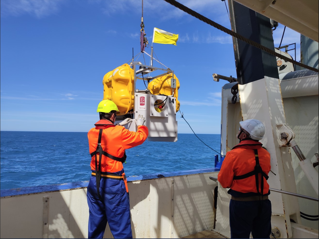
A large component of the project involves building and installing seafloor sensors off the East Coast to detect offshore earthquakes, slow slip events, and reveal New Zealand’s offshore plate tectonic movements for the first time. Similar types of sensors could be used in tsunami and earthquake early warning systems in the future and will create new technological capability for New Zealand. Part of this project provides resources for New Zealand scientists to work on the new data being collected by visiting specialised research ships that carry out drilling and seismic imaging. This data will tell them about the physical conditions and rock types at the plate boundary, and reveal what is causing the Hikurangi subduction zone to move slowly (in slow slip events) or suddenly (in earthquakes). This helps scientists understand what has influenced earthquakes and tsunamis in the past, so they can better anticipate what might happen in the future.
The scientists will also be gathering geological and historical evidence for past large Hikurangi earthquakes to improve our understanding of subduction zone hazards posed to New Zealand. This involves collecting offshore cores and studying coastal sediments to explore the geological record of past earthquake and tsunami events. They will be working with iwi partners to integrate Mātauranga Māori of past Hikurangi earthquakes and tsunami.
For more information check out these three project fact sheets:
- Hikurangi Project Overview Fact Sheet
- Hikurangi IODP Drilling Fact Sheet
- Hikurangi Seismic Surveying Fact Sheet
This project finished in September 2021, check out these resources to get the full story:
- Bite-sized Documentary: "1 in 4 chance in the next 50 years" Scientists explain their work on the Hikurangi Subduction Zone
- The Project in Numbers infographic (for a print-quality version, please contact info@eastcoastlab.org.nz)
- Project Timeline Storymap
Latest news
Check out our videos
Disclaimers and Copyright
While every endeavour has been taken by the East Coast Lab Hikurangi Subduction Zone M9 to ensure that the information on this website is
accurate and up to date, East Coast Lab Hikurangi Subduction Zone M9 shall not be liable for any loss suffered through the use, directly or indirectly, of information on this website. Information contained has been assembled in good faith.
Some of the information available in this site is from the New Zealand Public domain and supplied by relevant
government agencies. East Coast Lab Hikurangi Subduction Zone M9 cannot accept any liability for its accuracy or content.
Portions of the information and material on this site, including data, pages, documents, online
graphics and images are protected by copyright, unless specifically notified to the contrary. Externally sourced
information or material is copyright to the respective provider.
© East Coast Lab Hikurangi Subduction Zone M9 - www.eastcoastlab.org.nz / +64 6 835 9200 / info@eastcoastlab.org.nz


