Two plates
Earth's crust is not solid, it's broken up into tectonic plates. These plates are constantly moving, and where they meet is called a plate boundary.
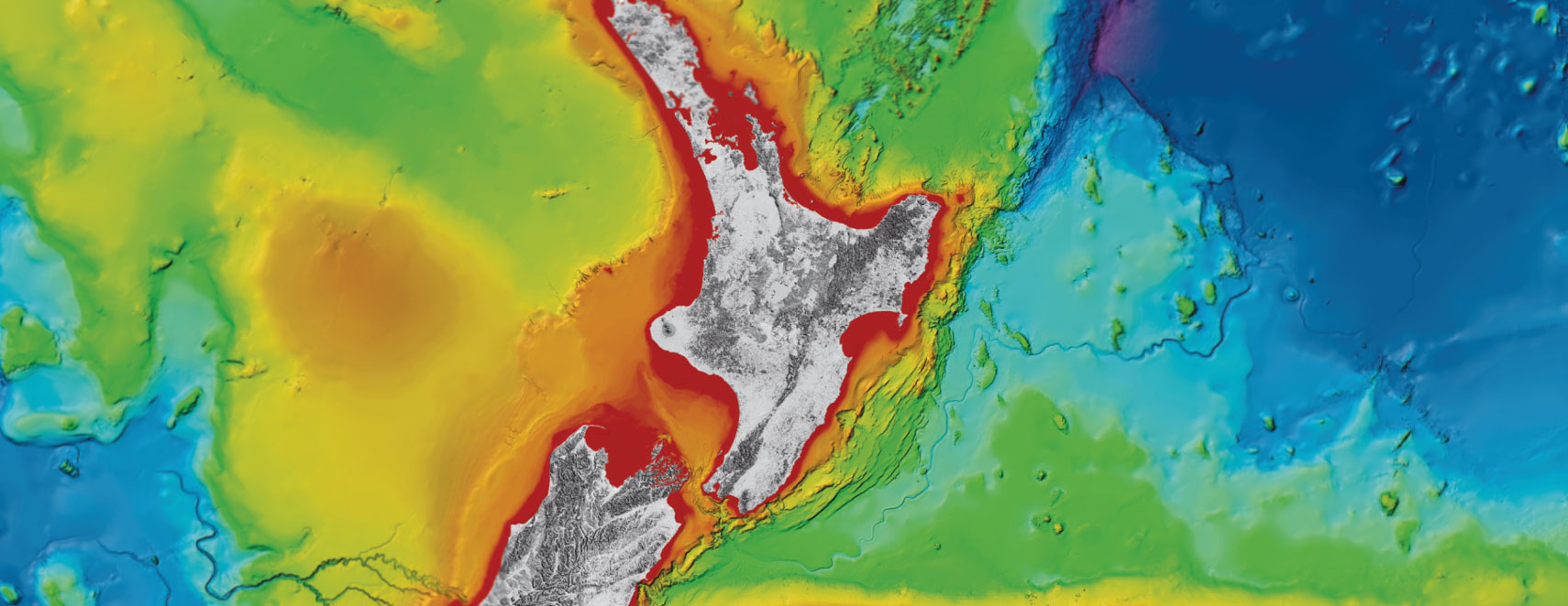
Aotearoa straddles the boundary of two tectonic plates: The Pacific plate to the east, and the Australian plate to the west. This plate boundary runs the length of Aotearoa.
The Hikurangi Subduction Zone runs along the east coast of Te Ika-ā-Maui, the North Island, down to Kaikoura in Te Waipounamu, the South Island.
In Te Waipounamu, the plate boundary crosses over towards the west, and becomes the Alpine Fault. Between the Hikurangi Subduction Zone and the Alpine Fault is a broad area of complex active faults, called the Marlborough Fault System.
 There are three types of plate boundaries:
Subduction is a type of convergent plate boundary, where one plate dives down beneath another. In this case, the Pacific plate subducts, or dives down, westward beneath the Australian plate.
Subduction zones produce the largest earthquakes in the world. Two famous examples of subduction zone earthquakes and subsequent tsunami are:
The HSZ is more than meets the eye - while the plates first meet off the east coast, the Pacific plate continues to dive beneath Te Ika-ā-Maui, moving at about the same rate that your fingernails grow!
If you're in eastern or lower Te Ika-ā-Maui, the Pacific plate is right beneath your feet:
Tūranganui-a-Kiwa, Gisborne - the Pacific plate lies 15km beneath your feet.
Te Matau-a-Māui, Hawke's Bay - the Pacific plate lies 18km beneath your feet.

In some parts of the subduction zone, the plates are slowly creeping past one another, this is called slow slip.
Slow slip releases pressure just like an earthquake would, but over days, weeks, or even months, rather than seconds or minutes as in an earthquake. In fact, it is so slow that it can't be detected by humans, instead we rely on GPS instruments to detect the few millimeters of movement occurring each year.
In other parts, the plates are stuck, locked together building up pressure. Studying both the slowly slipping zone and the stuck zone of the subduction zone, gives scientists clues as to how the plates interact with each other, which helps to inform their understanding of potential future earthquakes and tsunami.
Our spot, at the boundary of two tectonic plates, is what gives Aotearoa its extraordinary landscape. From the Southern Alps driven up by the Alpine Fault, to the Taupō Volcanic Zone which sits above a thin piece of crust where the Pacific plate subducts beneath the Australian plate, the plate boundary created our natural playground.
However, life at the boundary comes with hazards, and we must be prepared. The Hikurangi Subduction Zone is Aotearoa's largest source of earthquake and tsunami hazard. In fact, recent research has shown there is a 1 in 4 chance of a major Hikurangi Subduction Zone event in the next 50 years. We can't predict earthquakes, but scientists can determine when major earthquakes happened in the past and use this to understand their likelihood in the future.
The Hikurangi Subduction Zone is capable of a magnitude 9 earthquake, similar to the earthquake that occurred in Japan in 2011. This would cause severe to extreme shaking across Te Ika-a-Māui and even the top of Te Waipounamu.
This earthquake could cause a tsunami which could arrive within minutes of a long or strong earthquake, it is unlikely that there will be time for an official warning to be issued before the tsunami arrives. Remember:
Don't hesitate, move to higher ground or further inland immediately. Never wait for official warnings, the natural warning signs may be the only warning we get for a tsunami from the Hikurangi Subduction Zone.
Check out GetReady.govt.nz for more information on how to prepare.


Disclaimers and Copyright
While every endeavour has been taken by the East Coast Lab Hikurangi Subduction Zone M9 to ensure that the information on this website is
accurate and up to date, East Coast Lab Hikurangi Subduction Zone M9 shall not be liable for any loss suffered through the use, directly or indirectly, of information on this website. Information contained has been assembled in good faith.
Some of the information available in this site is from the New Zealand Public domain and supplied by relevant
government agencies. East Coast Lab Hikurangi Subduction Zone M9 cannot accept any liability for its accuracy or content.
Portions of the information and material on this site, including data, pages, documents, online
graphics and images are protected by copyright, unless specifically notified to the contrary. Externally sourced
information or material is copyright to the respective provider.
© East Coast Lab Hikurangi Subduction Zone M9 - www.eastcoastlab.org.nz / +64 6 835 9200 / info@eastcoastlab.org.nz