Tairāwhiti one of the most studied areas of slow-motion earthquake activity in the world

Scientists are about to embark on the largest seafloor geodetic and seismological instrument deployment ever carried-out to study offshore slow slip events.
This milestone study will make Tairāwhiti’s shores one of the most studied areas of slow-slip activity in the world.
Slow-slip events are slow motion earthquakes that occur when two tectonic plates start lurching slowly past one another. These events take place over days, months, or even years, rather than in seconds like a normal earthquake.
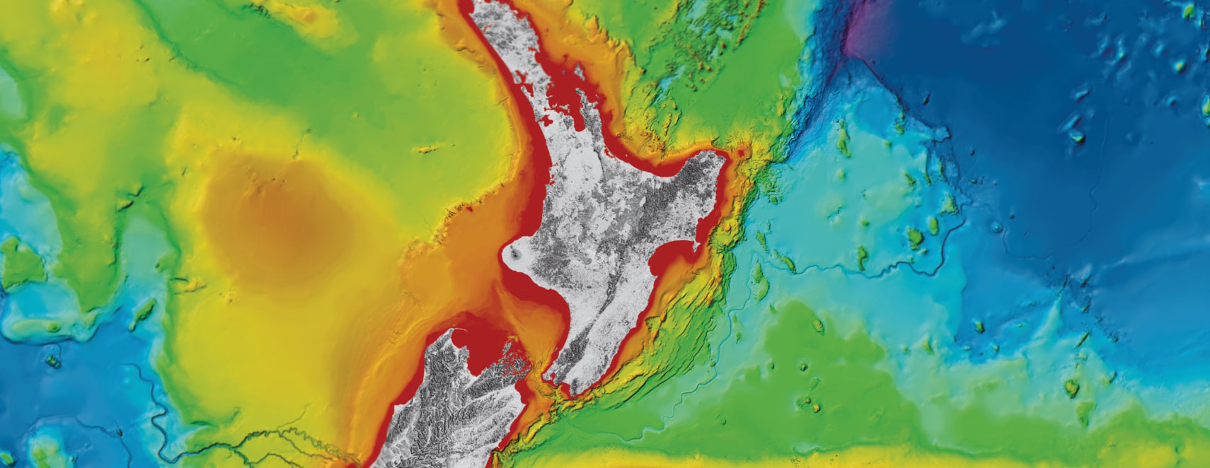
Slow-slip has been detected regularly on the Hikurangi Subduction Zone, our largest and most active fault, where the Pacific Plate dives down westward beneath the Australian Plate, just off the East Coast of Te Ika-a-Māui/the North Island.
This slow release of energy means slow-slip events are undetectable by humans and even typical seismometers, as they don’t produce any noticeable shaking. Instead, scientists must use GPS and seafloor pressure sensors to detect the tiny (millimetre to centimetre) movements.
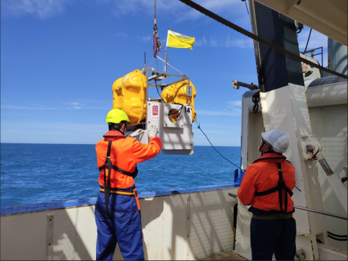
To better understand the slow slip activity happening on the Hikurangi Subduction Zone scientists from Aotearoa New Zealand and around the world will be deploying 50 instruments offshore from Tairāwhiti. These instruments will be in place recording earthquakes and slow slip events for two years.
“This is a huge deployment of a range of different instruments” said Dr Laura Wallace, from GNS Science. “Over 40 of the instruments have seafloor pressure sensors which can detect vertical movement of the seafloor down to the centimetre.”
This international study brings together geophysicists with oceanographers to greatly improve the understanding of vertical movement of the ocean floor during slow slip events and is one of the first studies of its kind to do so.
Researchers have come from Columbia University and University of Rhode Island in the USA, and the University of Tokyo, Kyoto University, and Tōhoku University in Japan, to join GNS Science researchers on the NIWA research vessel Tangaroa.
Ocean currents and large coastal eddies in the deep ocean create “noise” in the seafloor pressure data, which makes it more challenging to detect the smallest movements of the seafloor.
“By deploying oceanographic sensors, we can accurately characterize the ocean eddies and then remove that “noise” from the seafloor pressure data to reveal where the slow slip events are occurring in unprecedented detail,” said Professor Randy Watts of the University of Rhode Island, the lead physical oceanographer on the team.
Before this study, scientists were able to detect seafloor movement of a few centimetres or more. With this new combination of techniques, the team hopes to detect seafloor movement as small as half a centimetre.
“Having so many diverse types of sensors in place for the two year period will give us our highest-resolution view yet of what’s happening on the offshore subduction zone and how slow motion earthquakes relate to earthquakes and tsunami.” Said Dr Wallace.
The Hikurangi Subduction Zone is Aotearoa’s largest source of seismic hazard, with the potential to generate earthquakes as large as a magnitude 9, which would result in a tsunami impacting the whole of the east and south coast of Te Ika-a-Māui/North Island and parts of Te Waipounamu/South Island.
Ongoing research into the Hikurangi subduction zone is essential to understanding this hazard and the risk it poses to communities.
https://www.youtube.com/watch?v=qGdjAyD67cs&t=4s
10 February 2023
Disclaimers and Copyright
While every endeavour has been taken by the East Coast Lab Hikurangi Subduction Zone M9 to ensure that the information on this website is
accurate and up to date, East Coast Lab Hikurangi Subduction Zone M9 shall not be liable for any loss suffered through the use, directly or indirectly, of information on this website. Information contained has been assembled in good faith.
Some of the information available in this site is from the New Zealand Public domain and supplied by relevant
government agencies. East Coast Lab Hikurangi Subduction Zone M9 cannot accept any liability for its accuracy or content.
Portions of the information and material on this site, including data, pages, documents, online
graphics and images are protected by copyright, unless specifically notified to the contrary. Externally sourced
information or material is copyright to the respective provider.
© East Coast Lab Hikurangi Subduction Zone M9 - www.eastcoastlab.org.nz / +64 6 835 9200 / info@eastcoastlab.org.nz
