Robots help scientists study hazards posed by the Hikurangi subduction zone

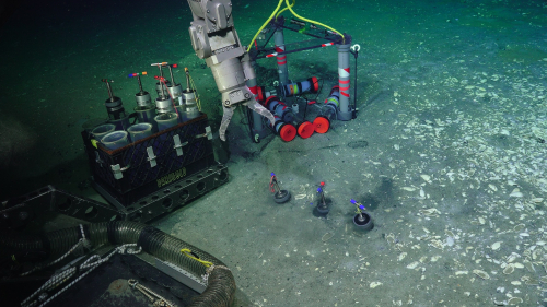
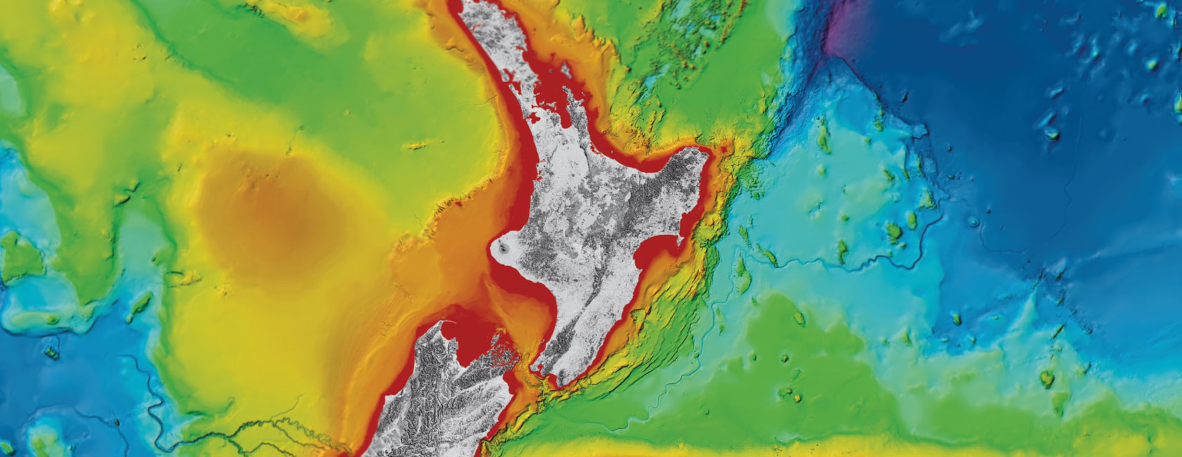
An underwater remotely operated vehicle (ROV) called Jason is helping an international team of scientists study the Hikurangi subduction zone, where the Pacific Plate dives down beneath the east coast of the North Island.
Scientists have just returned from a trip aboard the US research vessel Roger Revelle, using the vehicle to install seafloor instruments, collect samples, and download data from earthquake observatories along the Hikurangi subduction zone.
This information will help them understand the role that water deep beneath the seafloor plays in affecting the likelihood and type of earthquakes that occur along the Hikurangi subduction zone.
“Water emerging at the seafloor is a messenger from the deep,” voyage leader Associate Professor Evan Solomon from the University of Washington says.
“The make-up of the water will tell us about the environment deep down beneath the seafloor where earthquakes occur.”
The seafloor instruments installed during this expedition add to an already large and diverse number of instruments currently monitoring the Hikurangi subduction zone offshore.
“This is the first time an ROV has been used at the Hikurangi subduction zone, giving us an amazing opportunity to survey sites where water is venting at the seafloor and collect valuable observations of these environments and fauna around the vent sites. This will help us to understand the wider processes that drive the likelihood and type of earthquakes that occur at faults beneath the seafloor,” Dr Jess Hillman of GNS Science says.
The robotic vehicle Jason also retrieved data from two earthquake observatories that were installed beneath the seafloor by the research vessel JOIDES Resolution early last year to monitor slow slip earthquakes off the coast of Gisborne.
Slow slip earthquakes are where movement between the tectonic plates occurs slowly across the subduction zone, over a period of weeks to months, rather than suddenly in a large earthquake.
These slow slip earthquakes occur every one to two years off the coast of Gisborne, and it is considered one of the best places in the world to study these types of earthquakes.
“We are hoping that we will sense and record changes in the Earth during at least a few cycles of these slow slip earthquakes over the next several years so we can try and figure out why they occur,” Dr. Laura Wallace from GNS Science says.
GNS Science has created a short animated film which explains the process involved in a slow slip earthquake and outlines some of the research being conducted by the international team of scientists.
[YouTube id=xgk2zBvdOgw]
The data and samples recovered by ROV Jason will provide information on changes in the rock and sediment surrounding the subduction fault, giving clues about how and where stress is building or being relieved.
“This is only one piece of puzzle we are slowly putting together to better understand the relationship between earthquakes and slow-slip earthquakes,” says Dr Solomon.
Disclaimers and Copyright
While every endeavour has been taken by the East Coast Lab Hikurangi Subduction Zone M9 to ensure that the information on this website is
accurate and up to date, East Coast Lab Hikurangi Subduction Zone M9 shall not be liable for any loss suffered through the use, directly or indirectly, of information on this website. Information contained has been assembled in good faith.
Some of the information available in this site is from the New Zealand Public domain and supplied by relevant
government agencies. East Coast Lab Hikurangi Subduction Zone M9 cannot accept any liability for its accuracy or content.
Portions of the information and material on this site, including data, pages, documents, online
graphics and images are protected by copyright, unless specifically notified to the contrary. Externally sourced
information or material is copyright to the respective provider.
© East Coast Lab Hikurangi Subduction Zone M9 - www.eastcoastlab.org.nz / +64 6 835 9200 / info@eastcoastlab.org.nz
